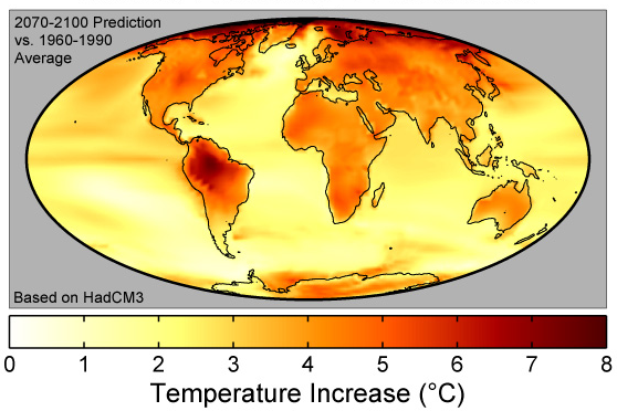
After the revelation that July and August tied as the warmest months ever recorded in human times, the discovery of a potentially habitable planet circling a red dwarf star that is part of the nearby Alpha Centauri system was welcome news. Proxima Centauri b is the closest Earth-like planet beyond the solar system, 4.3 light years away. By the year 2500, when a new study predicts almost 50 feet of sea-level rise — which would wipe out the homes of billions, erasing whole nations from the globe — we should have the star drive needed to migrate to a new planet.
 |
It is safe to say that no magical technological solution like a star drive is going to help the hundreds of millions who stand to lose their homes, their jobs, and their economic and natural resources by century’s end if not sooner. This affects more than Bangladesh and low-lying island states. Hundreds of populous cities, in rich countries and poor alike, are located along coastlines that stand to be radically redrawn.The problem is that the same study, published in Nature in March, predicts a near-term disaster: because of new science showing rapid melting of Antarctic ice sheets, the authors predict that sea-level rise under a business-as-usual scenario could add up to more than six feet by 2100 — within the lifetime of today’s infants. The effects, twice previous predictions, will be huge.
A major problem in addressing climate change is the lack of attention to the impending situation. A study by Media Matters revealed that the networks virtually ignored three huge climate developments last year: Pope Francis’s encyclical on the environment; President Obama’s Clean Power Plan for utilities; and the Paris Agreement by over 190 countries to hold the temperature increase to 2 degrees Celsius. A survey published in August revealed that the vast majority of Americans had never heard of the CPP.
Galloping to the rescue is new research based on the same 2100 timeline that could help to galvanize public opinion. The data make convincing points through clear, understandable maps and their implications about economic and environmental effects.
A good first stop is the excellent sea-level rise emulator at coast.noaa.gov/slr, which allows you to simulate up to six feet of rise anywhere in the United States, the same as the Nature prediction for century’s end.
Taking that same six-foot increase and timeline, “The real estate data firm Zillow recently published a research analysis that estimated rising sea levels could leave nearly 2 million U.S. homes inundated by 2100, a fate that would displace millions of people,” according to the Washington Post. Zillow is the popular website that has a database including nearly every home in the country, as well as an estimate of its market value. What Zillow has done is put a dollar sign on sea-level predictions.
Based on Zillow’s analysis, Florida will be the hardest-hit state, with one in eight homes affected. Crunching the numbers for its readership, the newspaper revealed that 100,000 homes in Maryland and Virginia would be lost. A series of maps shows the scheduled inundation in key cities.
 |
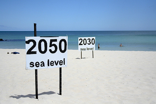
| Photo by go_greener_oz |
The Post noted that this is a worst-case scenario. Full compliance with the Paris Agreement might mean only two feet of sea-level rise, but even that will flood parts of some cities. However, under business as usual, “the results are grim. With six feet of sea-level rise, nearly 2 percent of all U.S. housing stock could vanish, accounting for roughly $882 billion worth of homes.” The final cost will of course be much higher, as businesses, farmland, and infrastructure get wiped out as well.
Another collection of maps, based on data from the Climate Central research group, is if anything even more disturbing. “By the end of the century, the number of 100-degree days will skyrocket,” the New York Times reports, “making working or playing outdoors unbearable, and sometimes deadly.” The Times presents three maps. Under the one depicting the baseline, 100 degree days in the lower 48 states are rare. A small swatch has more than five such days per year — mostly in the Southwest and California’s Central Valley, where much of our food is grown.
The second map shows the situation in 2060. Hot temperatures have spread like a cancer. Half the country now has 5 to 10 such 100 degree days. The regions mentioned above will have as many as 100 unbearable high temperature days. And needless to say, there will also be dozens of uncomfortable days in the 90s. Life will be hard.
The third map shows temperatures in 2100. Now, half the country, most of which rarely experiences 100 degrees today, will have at least 50 such extra-hot days a year, with some cities scheduled for twice as many. Life for many will be challenging under such a scenario, let alone the effect on agriculture and the wider economy.
Adding up the numbers from sea-level rise and hot temperatures under business as usual, the impacts on Americans’ health and security are likely to be profound. Businesses will suffer too. Governments’ response will be difficult. Our only hope is a change in the country’s relationship to fossil energy.
